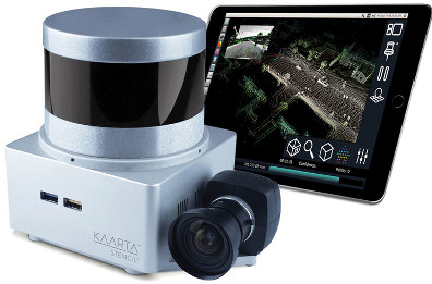
Kaarta Stencil 2-16 is a versatile low cost mobile mapping platform with a range of 100 meters and a data rate of 300,000 points per second. Stencil 2-16 can be hand carried, vehicle mounted or drone mounted for use across a wide variety of exterior and large interior applications.
Kaarta Stencil 2
Real-time, high fidelity 3D mobile scanning and generation
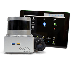
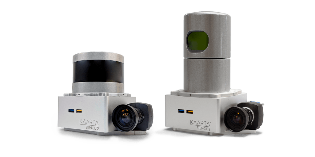
Stencil 2-16
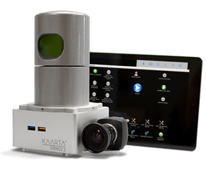
Stencil 2-32
Stencil 2-32 accurately scans ground level surfaces, mapping items such as curbs, manholes, signs, poles, and other features at a fraction of the cost of a Mobile Mapping System (MMS). Stencil 2-32’s integrated 3D mapping and real-time position estimation rapidly captures and processes data with a range of 100 meters and a data rate of 720,000 points per second.
Technology
At the heart of Stencil 2 is Kaarta Engine, Kaarta’s patent-pending advanced 3D mapping and localization algorithms. Kaarta Engine’s proprietary approach surpasses the drift error of alternative SLAM systems by an order of magnitude.
Stencil 2 accurately maps exterior and large interior spaces quickly and easily with a range of up to 100 meters with a lidar accuracy of ±30mm. Accuracy is improved by Kaarta’s advanced processing techniques, usually to ±10mm post-processed for typical environments. Data rate is 300,000 points per second up to 10Hz.
Stencil 2’s user interface and on-screen keyboard accessed on the included tablet makes real time operation easy, organized, and intuitive; giving users better control over scanning operations, parameter input, and file management.
Confidence Metrics provide immediate feedback on the quality of scans by signaling whether new scan data is registered properly in the existing map, estimating the likelihood of errors and allowing the user to increase the level of confidence by adjusting data collection techniques or adjusting parameters. Automated Floor Leveling/Sectioning algorithms identify floor structures and smart-scan leveling for better scans and reduced post-processing time. Floor Planner automatically levels, rotates, and generates 2D images of a “slice” from a point cloud.
Specifications
- Range: 100m
- Density: 300 000 points/secs
- Field of View: 360° horizontal FOV
- Rate: ~ 2.5 hrs to scan 10km2
- Accuracy: Laser accurate to ± 30mm
- Format: .ply files or .las
- Storage: 1TB SSD
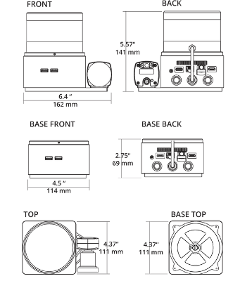
- Weight: 700g without LiDAR or 1600g with
MAP WITHOUT GNSS OR OTHER INFRASTRUCTURE…
Scanning beneath tree canopies, inside buildings, or in areas where GPS is obscured? No problem. Stencil doesn’t need GPS for fast, accurate, and low-cost 3D real-time simultaneous localisation and mapping.
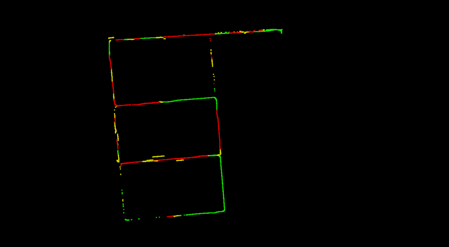
Vehicle GPS Trajectory with RTK dropouts
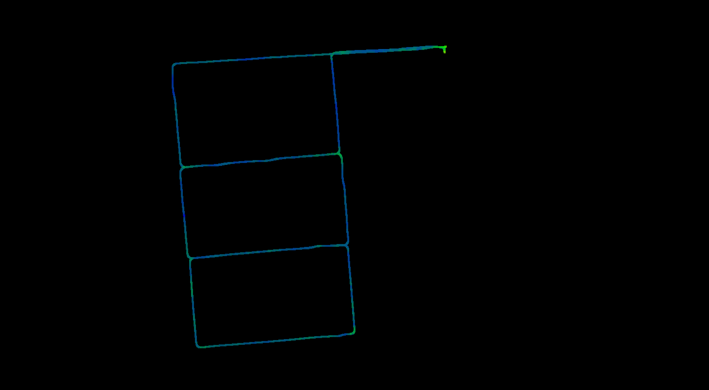
Stencil 2 Trajectory with GPS
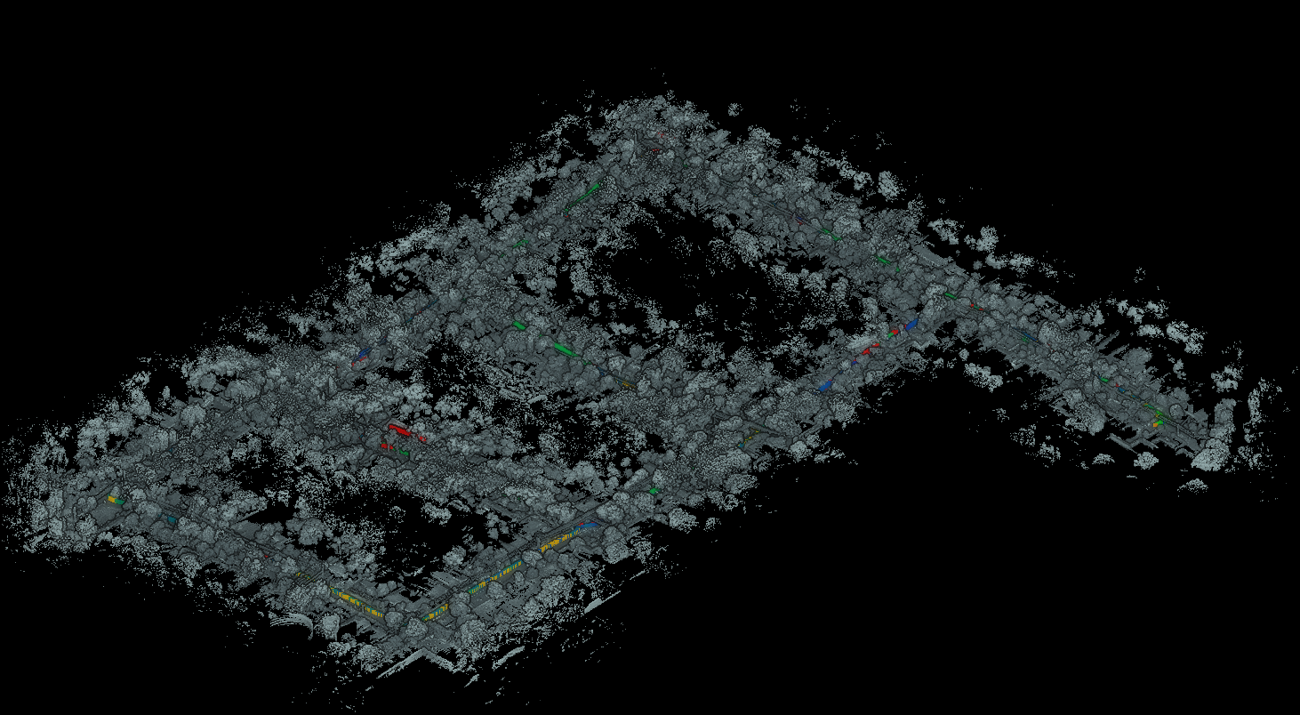
Complete capture in dense bush environment
Kaarta Stencil® 2 is a low cost, customisable mobile mapping platform for rapid mobile scanning; a computer small enough to fit in your hand but powerful enough to process and view any of the data it captures. Stencil 2’s integrated 3D mapping and real-time position estimation allows capabilities not possible with fixed-base scanning systems.
…OR CORRECT LARGE AREAS WITH THE AID OF GNSS
Stencil 2 also records GNSS data for use in loop closure to georegister and geolocate datasets, correcting for drift and further enhancing the fidelity of large area scans. Kaarta provides an optional GNSS receiver and bracket kit or Stencil 2 integrates with other NMEA 0183 GNSS systems.
FLEXIBLE AND ADAPTABLE FOR MANY APPLICATIONS
The combination of small size and customizable capture hardware creates a system that is endlessly adaptable. Stencil 2 base configuration is an aluminum enclosure with machined plates for lidar mounting and adapters as well as mounting points to attach to monopods, ATVs, UAVs, drones, etc. Feature Tracker, a high frame-rate imaging device, enhances operation in open, unstructured environments. Stencil 2 accepts several lidar models including Velodyne VLP-16 and Velodyne HDL-32E.
Stencil is a turnkey system that contains everything needed to capture and process the captured data. No internet connection, additional computers, software licenses, or subscription needed. Stencil 2 serves as a stand-alone scanning solution but can also be used to complement or augment other scanners.
Stencil 2’s ease of use, breadth of applications, and streamlined workflow make it the perfect choice for infrastructure inspectors, surveyors, engineers, architects, facilities planners, security personnel, or anyone who needs an easy way to document the 3D world quickly and dependably.